Friday, September 30, 2011

Beach, Dunes, Seney Refuge, and Big Springs

Monday was my sister's last day in Grand Marais, so we took full advantage. After breakfast we first headed up into the dunes. Here is a shot of Diana climbing the "access" dune.


Once we climbed another dune or two to get a better view of Lake Superior, we spotted this freighter going by.


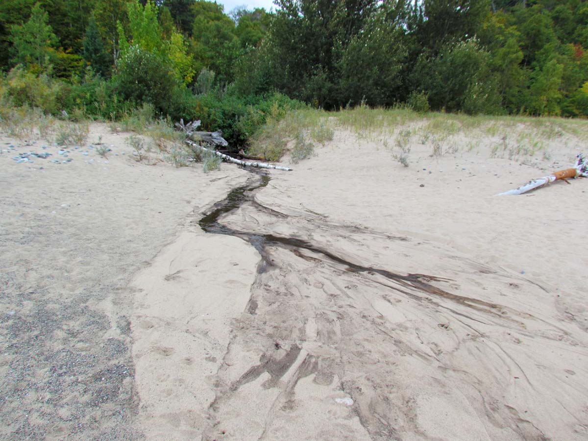
We also went down the beach to First Creek.  Due to the lack of rain, there is not much of a creek right now.  It doesn't even flow on the surface out to the lake.  It is amazing to think that our father used to fish in this creek.


Then we decided to head out of town to do a little sight seeing.  The colors in some of the stretches along the highway were spectacular.


Our first stop was the Seney National Wildlife Refuge.  This refuge was created by President Franklin D. Roosevelt in 1935.  It was carved out of the Great Manistique Swamp by the Civilian Conservation Corps.  Throughout this nearly 96,000 acres of diverse habitat live a wide variety of wildlife species. 


We didn't have a lot of time, but we did take the 7 mile drive.


The first wildlife we spotted were the swans.


There were also loons.


We saved this turtle that was crossing the road.


A deer didn't seem to be bothered much by us.


From Seney we headed west of Manistique to the Palms Book State Park.


At this state park the Kitch-iti-kipi spring is located.  It is the largest spring in the state.  You can click on the interpretive signs below to read more about this amazing natural spring.


To see the spring, there is a raft tethered by a cable. 


The sides of the pool are very steep with spring water bubbling up from the bottom at a rate of 10,000 gallons per minute.


Thursday, September 29, 2011

Mosquito Loop Hike -- Pictured Rocks national Lakeshore -- Post 2

I am getting ready for the Cranberry Festival show this weekend so I am going to double up on the quantity of pictures posted. I'll have other pictures when I get back, so I have to catch up a bit now.  To continue with the photos taken during the hike last weekend, we left Mosquito Falls and walked through the woods down a gently sloping hill for around a mile and a half to Mosquito Beach.


Here are a couple of shots showing where Mosquito River  flows into Lake Superior.


When you reach Lake Superior, there is a sandy beach to the west and a rocky beach to the east.  Here is the area to the west.  We had lunch while sitting on the log.  Notice the straight driftwood log that someone inserted into a hole in the big sitting log.  I think it looks kind of like a giraffe's neck and head.


Much of the rock lining and up on the beach is Jacobesville Sandstone.


The leaves are just starting to turn, but some trees are ahead of the others.


Half way across the rocky section of beach there is a point that allowsyou to look back to the west, as well as to the east.  Here is a shot looking west.


There were quite a few ducks in the area taking advantage of the sandy beach.  These ducks were staying clear of the kayakers in the area.


From the rocky point, here is a shot taken on the calm day looking east to what I call the Fred Flintstone cave.  The second photo below was taken a couple of weeks ago on the windy day.  Notice how Lake Superior changes her personality.


Here are two more shots showing the whole rocky beach.  One was taken last Sunday and the other a couple of weeks ago.  Notice how the storm surge moves the lake bed up the rocks around 20 or 30 feet.


More fall colors....


We left the Mosquito Beach area and headed back the main trail towards the parking lot.  This trail section is 1.9 miles long.


Helen left and went back to Marquette.  On the way home, Diana and I drove through the Kingston Lake campground.  I liked the colors in this lagoon.


We also stopped at the log slide.


While there, a fishing boat went by.  There are at least 9 outriggers!


Wednesday, September 28, 2011

Mosquito Loop Hike -- Pictured Rocks National Lakeshore -- Post 1

The only nice and sunny day during my sister's visit was on Sunday. That worked out well since that is the day we decided to go on a hike. We drove the new H58 to the trail head, but stopped at Hurricane River first so Diana could see the new bridge over the river.  She had driven past it the day before, but didn't get a chance to stop.


Then we met my friend, Helen, in Melstrand and drove to the Chapel-Mosquito trail head.  Rather than hike the entire loop, we decided to hike just the Mosquito half.


Tree roots define a lot of natural stairways along the trail.


There were fall colors evident everywhere.


Along the left side of the trail, there was a path that I had never taken.  We walked back around 50 feet and there was the remains of an old cabin.


Once we made the turn toward Mosquito falls, we followed the river.  Here is a gravel bar along the river.  Although you cannot agate hunt within the national park, gravel bars like this in other areas are candidates for agate hunting.


My sister, Diana....

My friend, Helen.....

After around a mile and a half, we arrived at Mosquito Falls.  It is actually a series of cascading falls.